

British Canoeing have put together 9 of the best canoe trails for this Spring around the heart of the country, to help you plan your next adventure. They have also included all the important information you will need before setting off.
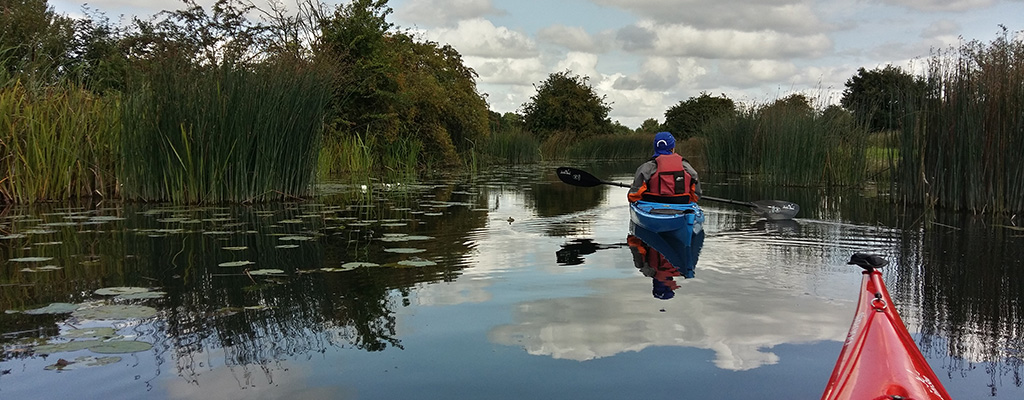
Birmingham and Black Country Canoe Trail 1: Brownhills to Sneyd
Distance: 8.5 miles Time: 2.5 - 4.5 hours Portages & Locks: None

©British Canoeing
Route: Often referred to as the 'Curly Wyrley', this first leg of the Birmingham & Black Country Canoe Trail meanders quietly along the Wyrley and Essington Canal, through suburbs, countryside and mining heritage. The Trail starts at Brownhills Canoe Centre, home of Royal Sutton Canoe Club, covering 10 miles along a historic canal.
Start: Wyrley and Essington Canal, Brownhills Canoe Centre, Silver Street, Brownhills
- Nearest Postcode: WS8 6DZ
- Parking: Parking at Brownhills Canoe Centre can be arranged by contacting the Brownhills Community Association.
Finish: Sneyd Wharf, Sneyd Lane, Walsall
- Nearest Postcode: WS3 2LT
- Parking: Parking is possible in the lane, if the barrier is open. Alternatively 24hrs access when parking on Vernon Way (100m carry to canal side).
License for waterways: The waterways in this trail are managed by the Bridgewater Canal Company and require paddlers to hold a license. British Canoeing membership includes a full annual license for this waterway - please take your membership card with you as this acts as your license. Non-members can either purchase a British Canoeing membership from www.britishcanoeing.org.uk or buy licenses direct from http://www.bridgewatercanal.co.uk/boating/licensing.
Bridgewater Canal; Little Bollington to Keckwick Hill Bridge
Distance: 11 miles Time: 3 - 6 hours Portages & Locks: None

©British Canoeing
Route: Canoe through rural Cheshire along the first canal in England to be built under an Act of Parliament. The small towns and villages bordering the canal bring much of the charm to this trail.
Start: Ye Old No 3 Public House, Little Bollington.
- Nearest Postcode: WA14 4TA
- Parking: Parking is available in the large lay-by by the pub.
Finish: Keckwick Hill Bridge, Daresbury
- Nearest Postcode: WA4 4AN
- Parking: Free parking is available in the lay-by adjacent to the bridge.
License for waterways: The waterways in this trail are managed by the Bridgewater Canal Company and require paddlers to hold a license. British Canoeing membership includes a full annual license for this waterway - please take your membership card with you as this acts as your license. Non-members can either purchase a British Canoeing membership from www.britishcanoeing.org.uk or buy licenses direct from http://www.bridgewatercanal.co.uk/boating/licensing.
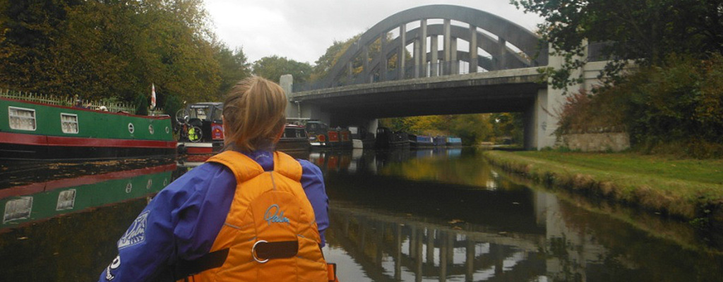
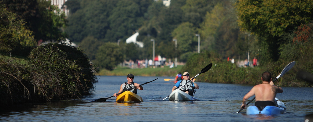
Bridgewater Canal; Worsley to Manchester
Distance: 7.5 - 8 miles Time: 2 - 4 hours Portages & Locks: None

©British Canoeing
Route: Enjoy a trip along what is generally thought to be, and referred to as, the first canal built in the UK. This trail truly encompasses a taste of past and present Greater Manchester; from countryside landmarks to iconic urban buildings.
Start: Barton Road, Worsley
- Nearest Postcode: M28 2PB
- Parking: Pay & display car park facing the Court House.
Finish: YHA Potato Wharf, Castlefield, Manchester
- Nearest Postcode: M3 4NB
- Parking: Book a space on: 0845 3719647 or park in car park across the road.
License for waterways: The waterways in this trail are managed by the Bridgewater Canal Company and require paddlers to hold a license. British Canoeing membership includes a full annual license for this waterway - please take your membership card with you as this acts as your license. Non-members can either purchase a British Canoeing membership from www.britishcanoeing.org.uk or buy licenses direct from http://www.bridgewatercanal.co.uk/boating/licensing.
Erewash Canal Trail Part 2 - Ilkeston to Trent Lock
Distance: 6.5 miles Time: 1 - 2 hours Portages & Locks: 6 locks

©British Canoeing
Route: The Erewash Canal tracks along the border of Nottinghamshire and Derbyshire, meandering through the countryside, and round the edges of the area’s towns and villages. In some parts urban, some parts rural, the canal plots a course through the area’s natural and cultural heritage.
Start: Gallows Inn Fields, Nottingham Road, Ilkeston
- Nearest Postcode: DE7 5BP
- Parking: There is a large, free public car park at Gallow's Inn Playing Fields at Ilkeston - take the road opposite the Gallows Inn Pub. From here there is a gap in the fence connection to the tow path and an entry to the water.
Finish: Trent Lock, Lock Lane, Long Eaton
- Nearest Postcode: NG10 2FY
- Parking: Unless completing the trail as an out and back route, a shuttle will be required to Trent Lock. There is a large free car park at the lock, by the Trent Lock pub.
License for waterways: The waterways in this trail are managed by Canal and Rivers Trust, and require paddlers to hold a licence. British Canoeing membership includes a full annual license for this waterway – please take your membership card with you as this acts as your license. Non-members can either purchase a British Canoeing membership from www.britishcanoeing.org.uk or buy licenses direct from www.canalrivertrust.org.uk.
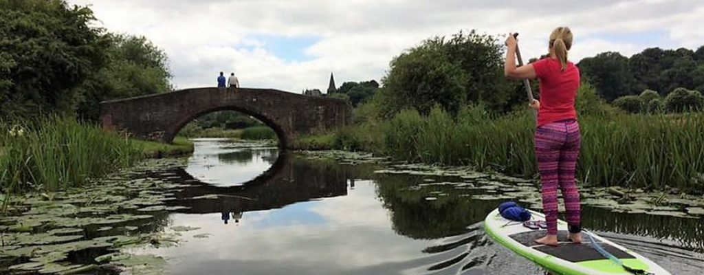
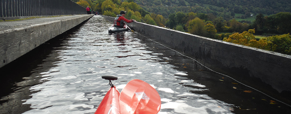
Llangollen Canal: Horseshoe Falls to Chirk
Distance: 10 miles Time: 2.5 - 5 hours Portages & Locks: No portages, but two tunnels where paddlers must adhere to navigation rules, with a forward facing light (or head torch) of at least 80 lumens.

©British Canoeing
Route: Paddle through a canal world heritage site, through tunnels and over an engineering wonder. The Pontcysyllte Aqueduct rises 127 feet above the River Dee; so if you are making the crossing, a head for heights may be required!
Start: Horseshoe Falls Carpark, off B5103
- Nearest Postcode: LL20 8BN
- Parking: Parking is free for National Trust members, or £3 all day for non-members.
Finish: Chirk Bank, Chirk
- Nearest Postcode: LL14 5BY
- Parking: There is a small car park alongside the canal.
License for waterways: The waterways in this trail are managed by Canal and Rivers Trust, and require paddlers to hold a licence. British Canoeing membership includes a full annual license for this waterway – please take your membership card with you as this acts as your license. Non-members can either purchase a British Canoeing membership from www.britishcanoeing.org.uk or buy licenses direct from www.canalrivertrust.org.uk.
Peak Forest Canal - Bugsworth Basin to New Mills Marina
Distance: 5 miles Time: 1.5 - 2.5 hours Portages & Locks: One (low swing bridge which may need to be portaged unless on paddleboards).

©British Canoeing
Route: A beautiful paddle on the edge of the Peak District National Park, with rolling countryside views and a glimpse into Derbyshire’s industrial past.
Start: Bugsworth Basin, Brookside, Buxworth, High Peak
- Nearest Postcode: SK23 7NE
- Parking: Free parking on the canal side on the gravel track.
Finish: As above.
License for waterways: The waterways in this trail are managed by Canal and Rivers Trust, and require paddlers to hold a licence. British Canoeing membership includes a full annual license for this waterway – please take your membership card with you as this acts as your license. Non-members can either purchase a British Canoeing membership from www.britishcanoeing.org.uk or buy licenses direct from www.canalrivertrust.org.uk.
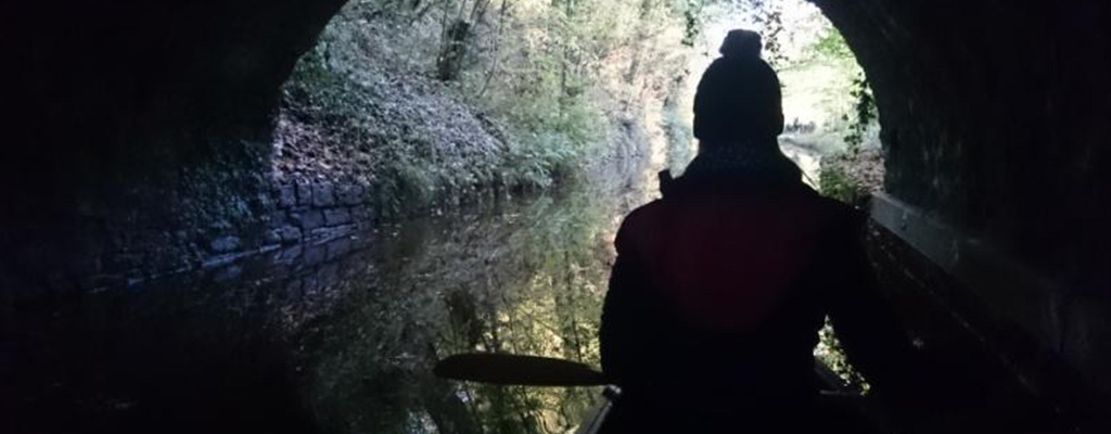
Peak Forest Canal; Dukinfield Junction to Marple Bridge
Distance: 7 miles Time: 2 - 4 hours Portages & Locks: 8 locks and 2 tunnels

©British Canoeing
Route: This journey takes you through stunning countryside with a deep industrial heritage. The navigation passes through two tunnels and crosses a great aqueduct, 97ft above the River Goyt, before reaching the flight of 16 locks at Marple.
Start: Portland Basin Museum Carpark, Ashton Under Lyne
- Nearest Postcode: OL7 0QA
Finish: Station Road, Marple
- Nearest Postcode: SK6 7BY
- Parking: It is a half mile walk to where the canal passes under Station Road, Marple. There are three free car parks near the station.
License for waterways: The waterways in this trail are managed by Canal and Rivers Trust, and require paddlers to hold a licence. British Canoeing membership includes a full annual license for this waterway – please take your membership card with you as this acts as your license. Non-members can either purchase a British Canoeing membership from www.britishcanoeing.org.uk or buy licenses direct from www.canalrivertrust.org.uk.
Peak Forest Canal; Marple to Whaley Bridge
Distance: 6.5 - 7.5 miles Time: 2 - 4 hours Portages & Locks: None

©British Canoeing
Route: A peaceful journey along the Peak Forest Canal with no locks or portages. At 518 feet above sea level this is the highest stretch of navigable water in the entire canal system. On a clear day you will get fabulous views of the Pennines and Kinder Scout to the south.
Start: Lockside, Marple
- Nearest Postcode: SK6 6BN
- Parking: You can unload your boats on Lockside, Marple but, as this is a residential street, you will need to move any cars to one of several car parks around the village.
Finish: Canal Basin, Whaley Bridge
- Nearest Postcode: SK23 7LS
- Parking: There is a free car park situated on the adjoining road, Tom Brads Croft.
License for waterways: The waterways in this trail are managed by Canal and Rivers Trust, and require paddlers to hold a licence. British Canoeing membership includes a full annual license for this waterway – please take your membership card with you as this acts as your license. Non-members can either purchase a British Canoeing membership from www.britishcanoeing.org.uk or buy licenses direct from www.canalrivertrust.org.uk.
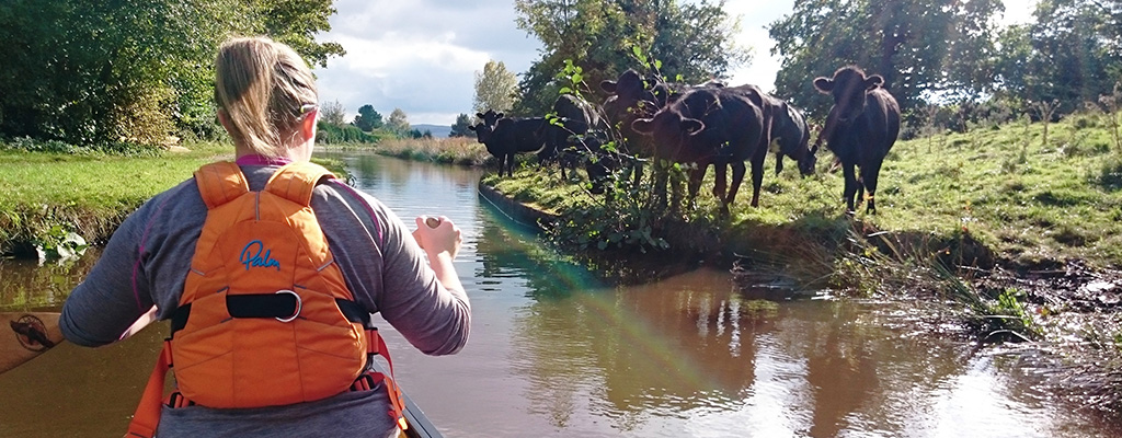
River Exe and the Exeter Ship Canal, Loop 1: Exeter Quay to Salmonpool
Distance: 2 miles Time: 1 hour Portages & Locks: Two weirs, which can be shot or portaged from river to canal.

©British Canoeing
Route: This is an unusual and pleasant trip right in the centre of a major city, taking a circular route down the River Exe, and back up the Exeter Ship Canal. It is an easy paddle at less than 2 miles long, and gives great views of the city to the east side. There are Waymarker points at get in/out locations with a canoe on them.
Start: Haven Road, Exeter
- Nearest Postcode: EX2 8BP
- Parking: On street, pay per hour parking.
Finish: As above
Lisence for waterways: The waterways on this trail don’t require you to have a licence to paddle on them. However if you paddle regularly you should consider becoming a member of British Canoeing. A British Canoeing membership gives you a whole range of benefits including a licence to paddle on 4500km of Britain's waterways and Civil Liability Insurance, worth up to £10 Million. Not only will membership help save you money, it will give you peace of mind when out on the waterways, www.britishcanoeing.org.uk.

In Partnership With British Canoeing
British Canoeing is the national governing body for canoeing and kayaking in the United Kingdom.
The purpose of British Canoeing is to; Inspire people to pursue a passion for paddling; for health, enjoyment, friendship, challenge and achievement.
Let us know you agree to cookies
We use marketing, analytical and functional cookies as well as similar technologies to give you the best experience. Third parties, including social media platforms, often place tracking cookies on our site to show you personalised adverts outside of our website.
We store your cookie preferences for two years and you can edit your preferences via ‘manage cookies’ or through the cookie policy at the bottom of every page. For more information, please see our cookie policy.